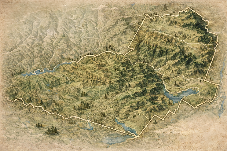
Around the Trails
Tucked into the heart of the Catskills, the Pine Hill trail system offers direct access
to forested ridgelines, quiet woodland paths, and sweeping mountain views. Whether you’re looking for a peaceful walk beneath towering hemlocks or a challenging climb to panoramic overlooks, Pine Hill delivers exceptional outdoor experiences in every season, from vibrant fall hikes and snow-covered winter treks to spring wildflowers and long summer days on the trail. Four seasons. Endless fresh air. Endless adventure.

Balsam Mountain from Rider Hollow
Balsam Mountain Loop Trail
Pine Hill Rail Trail
Cathedral Glen
Belleyre Mountian Trails
Giggle Hollow Trail
Rochester Hollow
Pine Hill Rail Trail
Slide Mountain
Giant Ledge and Panther Mountain
Click To Learn More

This scenic loop offers a rewarding challenge, with several sustained climbs as the trail rises over Belleayre Mountain before continuing on toward the summit of Balsam Mountain. The elevation gain is steady and noticeable, making it a satisfying route for hikers looking for a bit of a workout along the way. Although the summit itself is wooded and does not offer sweeping panoramic views, there is a beautiful overlook just before reaching the top that provides a perfect spot to pause, catch your breath, and take in the surrounding landscape.
To complete the full loop, hikers will follow short stretches of Woodchuck Hollow Road and Bonnie View Avenue. These road sections connect the trail segments and bring the route full circle.
Balsam Mountain Loop Trail
This trail offers a mix of forest paths, ski slope climbs, and ridge views, with sections that range from wide and easy to lightly maintained and more rugged. The lower woods are generally straightforward, but portions near the ski slopes and upper ridge can be confusing due to inconsistent markings, so steady navigation and attention to official DEC signs are key.
Cathedral Glen
COMING THIS SPRING
The Pine Hill Rail Trail is a planned multi-use path being built along the old Ulster and Delaware Railroad corridor between Pine Hill and Highmount. The first phase will turn about 2.6 miles of abandoned rail bed into a broad, accessible trail with pedestrian bridges that links the hamlet of Pine Hill with Highmount, Belleayre Beach, and nearby public lands.
Once complete it will offer a gentle, scenic route for walkers, bikers, and all ability levels while improving access to Shandaken Wild Forest and Belleayre Mountain trail networks.
Pine Hill Rail Trail
A peaceful forest stroll just outside Pine Hill, this easy creekside walk winds past a quiet pond, mossy woods, and gentle old woods roads. It is mellow, dog friendly, and perfect for when you want Catskills magic without climbing a mountain. Think birdsong, dappled light, and a calm reset in under a couple of hours.
Lower Birch Creek Trailhead
A mellow forest connector that starts near Belleayre Beach and slips quietly into the woods, this multi-use trail follows old woods roads toward the larger Belleayre Mountain trail network. It is mostly gradual, great for hiking or biking, and perfect if you want to start lakeside and wander deeper into the Catskills without committing to a full summit grind.
Giggle Hollow Trail
Belleayre Mountain’s trail network is best known for its summer hiking and winter snowshoeing and ski access, blending wide ski slope climbs with wooded paths that lead to sweeping ridge views. Routes range from steady, moderate ascents to longer backcountry connections, offering both open sky and classic Catskills forest.
It is a true four-season mountain, but it shines brightest when the slopes are either green and open under summer sun or snow-covered and crisp in winter.
Belleyre Mountian Trails
A Pine Hill area favorite with a satisfying climb and a classic Catskills woods feel the whole way. It is the kind of trail that makes you feel outdoorsy even if you are mainly here for the snack break.
Know before you go: Trailhead access is at the very end of Rider Hollow Road.
Balsam Mountain from Rider Hollow
Slide Mountain is a moderate climb and one of the highest peaks in the Catskills. While the summit is wooded, a nearby overlook offers wide views of the surrounding mountains.
The hike begins on the Phoenicia East Branch Trail, crossing a branch of the Neversink River. At 0.7 miles, turn onto the Wittenberg Cornell Slide Trail to reach the ridge just below the summit. Return the same way or take the Curtis Ormsbee Trail for a different route down.
Slide Mountain
Giant Ledge and Panther Mountain is a popular Catskills hike known for wide, dramatic views. The small parking lot fills quickly, and roadside parking is not allowed.
The trail begins on yellow blazes, then turns blue, climbing steadily over rocky terrain to Giant Ledge and beyond to Panther Mountain. Several open ledges provide excellent scenic overlooks. The hike ranges from moderate to challenging, and microspikes are recommended in winter due to ice.
Giant Ledge and Panther Mountain

The road to the Rochester Hollow trailhead is rough and may require a high clearance 4x4 vehicle. In winter, the route is intended for skiing or snowshoeing when snow is on the ground.
The trail system includes three marked paths totaling about six miles round trip, with roughly 900 feet of elevation gain in the first two miles. The blue trail follows a wide carriage road along a stream, while the yellow and red trails branch off into the woods at a fork.
Parking is a dirt lot off Spisak Way with no marked accessible spaces. The first mile is the most gradual, but steeper sections follow, which may be challenging depending on mobility and surface conditions.
Rochester Hollow Trail

The Catskills were made for exploring. From mountain trails to lakes, streams, and scenic places worth discovering, this page will soon be filled with ideas and local favorites to help you get outside and enjoy the area.
